presentation to investors.
From their recent corporate presentation, August 12:
Check out interesting thing on page 13.
Cabot claims that in 2012 they "De-Risked the Eastern Edge of our Acreage Position".
What do you suppose that could mean?
Creating 3 astroturf groups?
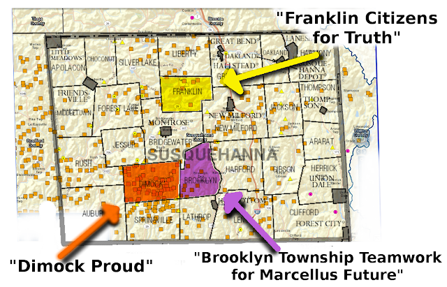 |
| Add caption |
Here is an interesting slide:
 |
| Very Inaccurate Pipeline Map |
What I find interesting is the map is quite inaccurate.
First, the Millennium (off-white) and the TGP300 line (green) DO NOT
cross, ever. And especially not at Hancock NY.
(See the map below. Millennium and TGP300 are both blue, with Millennium
a little darker and skinnier.) There is a star at the Hancock Compressor Station.
Interesting the "mistake" on the map just happens to be at Hancock, the site
of a new compressor station. Huh.
The second mistake is the violet Transco line. Notice the segment
that drops to the south approximately where Luzerne, Lycoming,
Sullivan, and Columbia nearly meet. This segment does not exist,
although it approximates one of the proposed routes for
the Commonwealth Pipeline, which was withdrawn.
There is a Southern branch of the Transco, starting around Trenton,
then South to Philadelphia, down to Lancaster County,
then into Maryland. (Transco is dark burgundy in the map below).

So I wonder: Are they intentionally filing false, innacurate documents with investors and maybe the SEC? (have to check other filings to see if this map is included.)
Is it just sloppy work?
Or is there another possibility?
Perhaps these show the routes of proposed pipelines
which have not been constructed yet?

No comments:
Post a Comment